How pilots handle thunderstorms comes down to one rule: they go around them, never through them. A crew reads the storm on onboard weather radar, keeps a wide buffer from the cell, and asks air traffic control for a different heading, altitude or route. The only time a jet enters storm-avoidance procedures is when the weather itself is worse than the terrain underneath it.
That is the whole safety philosophy in a sentence, and the rest of this article is how it actually gets executed — from the paperwork before the aircraft leaves the gate to the moment the cabin crew sits down in the last hour of a flight that has been circling an airport for weather reasons.
Updated for 2026.
Table of Contents
- 1How Pilots Handle Thunderstorms Before Takeoff
- 2Why Thunderstorms Are Dangerous to Aircraft
- 3What Pilots See on Weather Radar
- 4How Pilots Handle Thunderstorms in the Air
- 5What Happens If the Route Becomes Blocked
- 6How Cabin Crew Prepare Passengers
- 7Turbulence, Wind Shear, and Microbursts
- 8Can Lightning Damage an Airliner?
- 9How Passengers Can Stay Safe During a Storm
- 10Frequently Asked Questions
- 11Do pilots fly through thunderstorms?
- 12Why is turbulence more dangerous inside a thunderstorm?
- 13Can cockpit radar show exactly where the worst turbulence is?
- 14What should passengers do when an airplane enters rough air?
- 15What is the difference between wind shear and a microburst?
- 16Can lightning seriously damage a commercial aircraft?
- 17What to Remember First About Storm Avoidance
How Pilots Handle Thunderstorms Before Takeoff
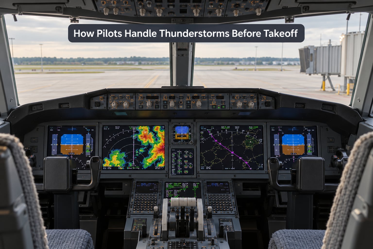
Thunderstorms are evaluated long before the engines start. If a storm is forecast to sit across the planned route, the answer is usually a different plan rather than a different landing.
The preflight picture comes from a stack of official products. A METAR and TAF give the current and forecast conditions at departure, arrival and alternate airports. A SIGMET flags significant weather such as severe thunderstorms, volcanic ash or turbulence. Convective outlooks describe where storms are expected to develop across a region during a window of hours.
On top of that sit pilot reports, abbreviated PIREPs, which are real observations passed from one crew to the next. A pilot in Florida who reports a cell building faster than forecast may be the single most useful piece of information another crew gets that hour.
Satellite imagery shows cloud-top structure. Radar mosaics show where precipitation already exists. The crew compares that against the terrain, because the alternative route to the east may not be available until 25,000 feet, and a route over high ground in a developing cell brings its own problem.
Fuel planning follows the weather, not the other way round. If the route adds distance around storm cells, alternate airports may change, and holding fuel must cover a wait for the cell to move downwind. A flight that cannot legally hold, or cannot reach an alternate within fuel limits, does not depart into that forecast.
Why Thunderstorms Are Dangerous to Aircraft
A convective cell packs several hazards into a small volume, and they arrive together.
Severe turbulence comes from updrafts and downdrafts inside the cell that can exceed 6,000 feet per minute. Hail is thrown upward by the strongest updrafts and can reach several centimetres across. Lightning, heavy rain and icing at altitude sit in the same stack. Just outside the cell, in the outflow region, a gust front and wind shear can be just as damaging, particularly at low altitude on approach.
Close to the surface, a microburst produces a powerful downdraft spread out in all directions, capable of forcing an aircraft into the ground on final approach. Engines also face hail ingestion, where ice is drawn into the intake and can flame the engine out.
Two terms matter for the rest of this article. The cell is the compact, violently rising column of air that produces the storm. The anvil is the wide, flattened ice cloud spreading downwind from the cell top, and it is the enormous black shape passengers often see from the window. The anvil is not harmless weather — thunderstorms and severe turbulence can be found well outside the visible rain area, which is one reason pilots are told to keep clear of the anvil as well as the cell.
What Pilots See on Weather Radar
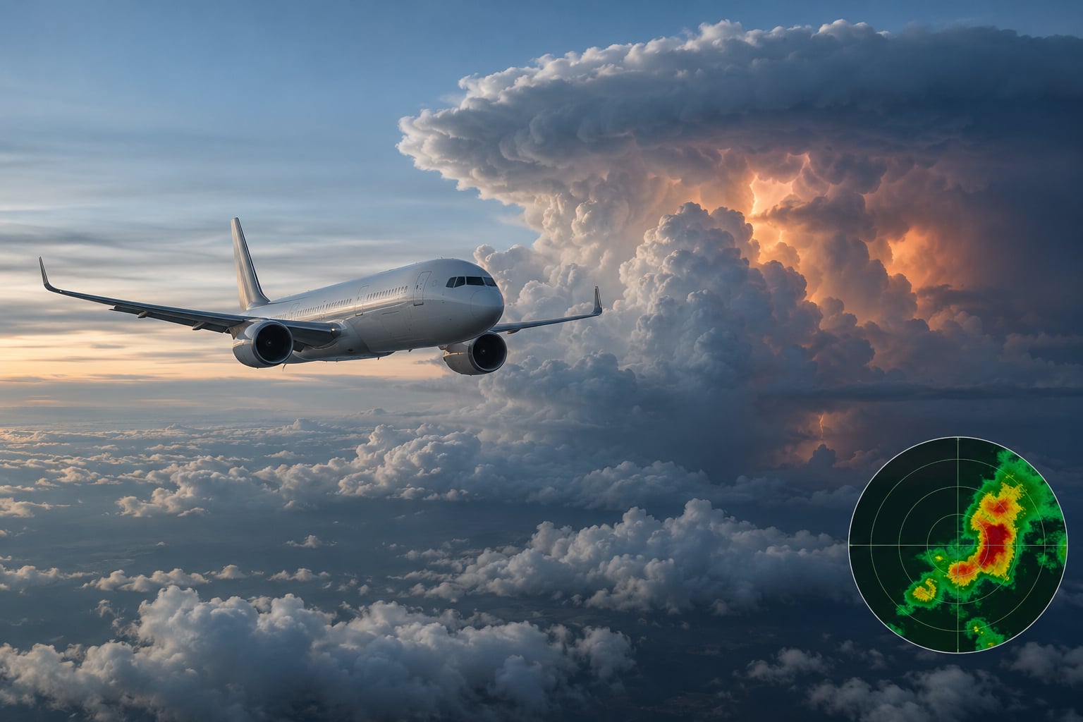
Cockpit weather radar sends out an electromagnetic pulse that bounces off water droplets, hail and rain inside a cloud, then returns to a scope in the cockpit. The strength of the return is what the colour on the display represents.
Green returns are light precipitation, yellow indicates heavier rain, red shows intense precipitation and magenta means extreme intensity. Reflectivity correlates with how violent the updraft is, which is why a red core is treated as a hard boundary and a magenta core as worse. Pilots also tilt the antenna to look at storm tops, and a cell with a top above the aircraft’s altitude can be flown around rather than under.
Radar has real limits. It does not see the anvil, so a storm can extend much further than the coloured returns suggest. It does not reliably detect severe turbulence inside a cell, only the associated precipitation. At night, attenuation weakens returns behind heavy rainfall, so a cell can look smaller than it is. And embedded cells within a larger mass of rain are easily missed altogether.
That gap between what the radar shows and what is actually happening is why crews fly bigger margins than the display seems to require.
How Pilots Handle Thunderstorms in the Air
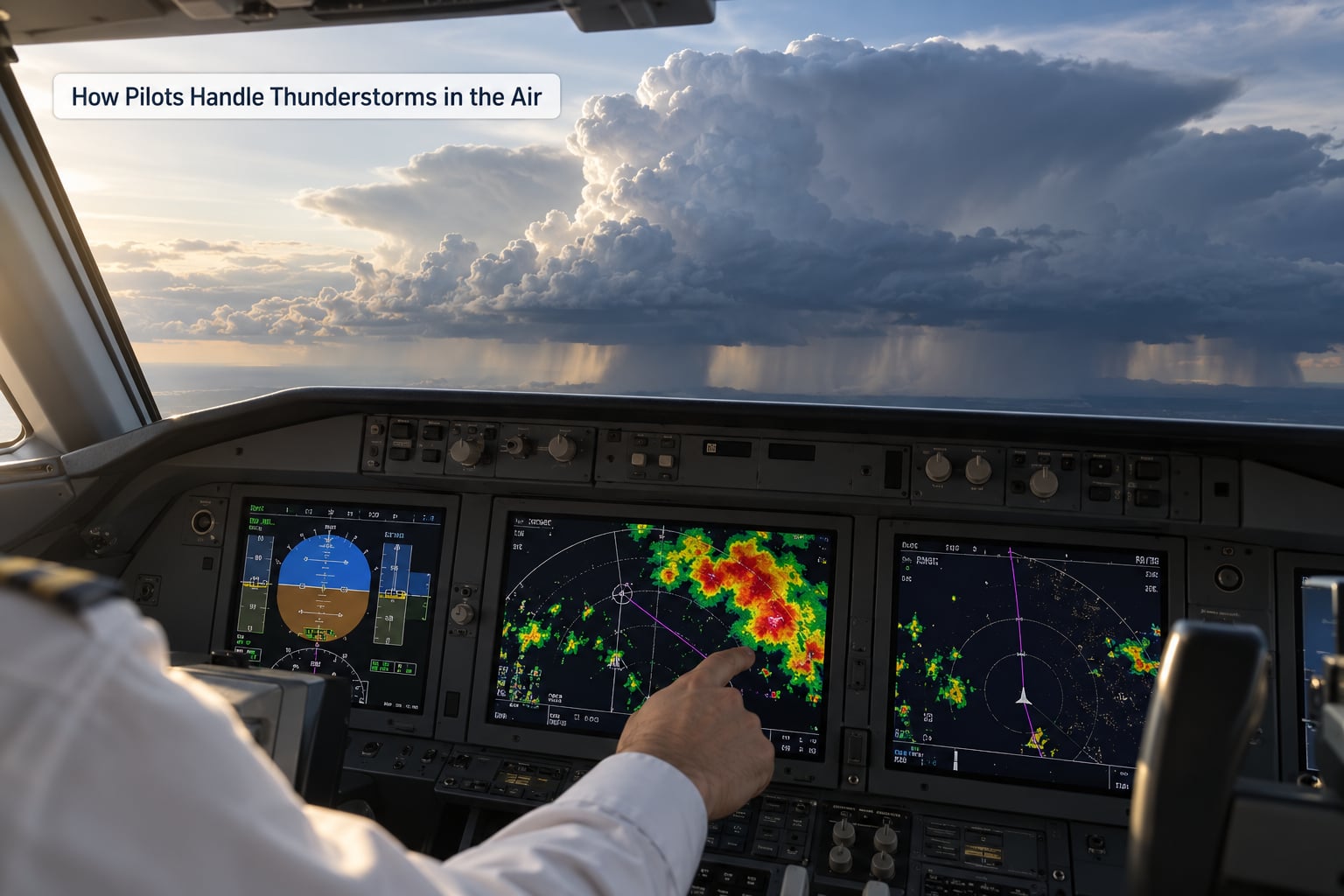
Once airborne, the same discipline applies continuously, and the crew works through a repeating loop rather than a single decision.
They scan the radar and compare it against the route ahead, watching cell development rather than a static picture. New cells do not wait for the crew to finish thinking. The storm they planned around at the gate may be a different shape at cruise level.
They keep separation. FAA guidance is at least 20 nautical miles from a large severe thunderstorm, at least 5 nautical miles from a small cell, and at least 40 nautical miles apart when two cells sit close together. A crew should never fly beneath a cell, because a dissipating storm’s downdraft extends outward and the air under an old-looking cloud can be the most dangerous air of the day.
They call air traffic control. A request for a heading or a different flight level takes seconds, and a controller who sees a cell you cannot see yet is a genuine safety resource. Pilots also have the authority to deviate from their clearance when safety requires it, and use that authority without apology.
They re-check fuel and terrain on every change. A 30-nautical-mile deviation is trivial on paper and can matter a great deal when the fuel is already committed to an approach at a busy airport.
At no point does the plan include flying through the storm. Every airline procedure and simulator session trains the same outcome: navigate around, or delay, or divert.
What Happens If the Route Becomes Blocked
When there is no clean way around, the crew has four options and picks among them based on fuel, terrain and time.
Ask for headings or a different altitude. A simple vector away from the cell often costs less time than anything else. Where published weather-procedure routes exist, they can be activated to provide predictable paths through forecast weather rather than improvised clearances.
Hold outside the hazard area. A holding pattern is a racetrack-shaped orbit that burns predictable fuel and keeps the aircraft clear, and it is commonly used when arriving aircraft must wait for a cell to move away from the approach path.
Divert to an alternate airport. The alternate was chosen before departure for a reason, and it may be replaced en route as conditions change. Diversion is a normal operation, not an emergency, and the cabin is told.
Or wait on the ground. Airlines cancel and delay flights precisely because going around a storm block sometimes means landing hours later somewhere worse. Forum discussion among pilots in r/flying reflects this: one cell sitting across a corridor can close an entire airway and force wide, fuel-hungry detours for traffic nowhere near the storm itself.
How Cabin Crew Prepare Passengers
Cabin crews work to a script that is deliberately split in two, because some items are comfort and some are survival.
Before take-off the cabin is secured and the seat belt demonstration happens. If severe turbulence is forecast, the crew explains that bumps are expected, that the seat belt fastened lowers the risk of injury considerably, and that the cabin should stay seated and buckled until the seat belt sign is switched off.
During the ride, service carts, galley items and loose cabin equipment are stowed. Crews move through the cabin and confirm passengers are seated. If the flight is going to be held or diverted, the announcement is made plainly and early, because passengers report the uncertainty hurts more than the delay itself.
What the crew says about lightning is worth listening to carefully. A flash and a jolt feel far more violent from a window seat than they do in the aisle, and a straightforward statement about aircraft protection reassures far better than a vague one.
Turbulence, Wind Shear, and Microbursts
These three get confused constantly, and they are genuinely different hazards with different responses.
Turbulence is chaotic motion of the air. It comes from mountains, from wake, from jet streams and from convection. Severe turbulence injuries in cabins overwhelmingly happen to passengers who were standing or unbuckled, which is why the belt instruction is the one that matters.
Wind shear is a change in wind speed or direction across a short distance, and near the ground it can push an aircraft into terrain on short final. Modern airliners carry predictive wind shear warning, a system that uses onboard lidar or radar to look ahead for the shear before the aircraft reaches it. When that warning sounds, the required response is immediate: apply maximum thrust, rotate to the commanded pitch attitude, and follow the escape procedure.
A microburst is a specific and violent type of low-level wind shear, a downdraft that hits the ground and spreads horizontally in all directions. The danger is the outflow beneath the aircraft, and it is the reason no crew will accept an approach into a cell that is sitting over the runway.
None of this can be read precisely from weather radar. That is the practical reason avoidance, rather than detection, is the primary defence.
Can Lightning Damage an Airliner?
Yes, a strike can damage an aircraft, and the aircraft usually still flies. Those two facts are both true.
Commercial aircraft get struck roughly once per 1,000 flight hours, and with several hundred flight hours a month that works out to a couple of strikes per aircraft per year, which is how both commonly quoted figures describe the same rate.
Protection is engineered rather than hoped for. A conductive aluminium skin and a fine conductive mesh woven through the composite structure let a strike travel across the surface and out of harm’s way. Static wicks on the trailing edges bleed off charge continuously in flight. Bonding and grounding connect engines, control surfaces, antennas and landing gear so that the current has a path that does not run through sensitive systems, and lightning arrestors sit on the radome and nose to protect the weather radar.
The airframe design certification requires aircraft to withstand lightning strikes, so what a strike usually produces is a brief loss of a radio signal or a momentary systems reset rather than a loss of control. Crews report the event, take a systems check, and continue. The US Aviation Safety Reporting System exists precisely so that an individual pilot or crew can report an error or a close call without the usual consequences, which is why r/flying discussions about accidentally entering a cell tend to end with technique advice rather than blame.
How Passengers Can Stay Safe During a Storm
Keep the seat belt fastened when seated. It is the one instruction that reduces injury risk most, and it costs nothing.
Follow crew instructions immediately rather than waiting to see whether the bumps continue. A cabin prepared for turbulence, with trays stowed and belts on, is a cabin that is already doing the safe thing.
Secure loose items, including headphones, laptops and anything in an overhead bin. Secure does not mean tightly stowed, it means closed or latched.
Do not assume every bump signals danger. Convective turbulence is uncomfortable and can be severe, but the structure of a transport aircraft is designed and tested for loads far beyond anything a thunderstorm produces.
If the crew goes around, it will usually feel like a sudden firm push and a climb back to 1,000 or 2,000 feet, sometimes announced. A go-around is a decision to try again under safer conditions, and it is exactly the choice the whole system is built to make.
Frequently Asked Questions
Do pilots fly through thunderstorms?
No. Pilots navigate around convective cells and never plan a route that enters one. The guidance they work to is roughly 20 nautical miles from a large severe cell, 5 nautical miles from a small cell, and 40 nautical miles between two cells. Penetration procedures exist, but they apply only to unavoidable light or moderate weather when no safer option remains, and airlines train crews to avoid that situation entirely.
Why is turbulence more dangerous inside a thunderstorm?
Inside a cell, updrafts and downdrafts stack in the same small volume and can exceed 6,000 feet per minute. That vertical motion, combined with hail and shifting wind, produces severe turbulence. Weather radar shows the associated precipitation, not the turbulence itself, so a crew cannot see the worst part of the ride on the display. Flying outside the cell is the only reliable protection.
Can cockpit radar show exactly where the worst turbulence is?
Not exactly. Radar returns reflect precipitation intensity, which correlates with storm strength but does not map turbulence directly. Radar also cannot see the anvil, has reduced detection range at night, and can miss small embedded cells inside large rain areas. A crew may still find significant chop in air that returns almost no colour, which is why pilots keep margins larger than the display seems to demand.
What should passengers do when an airplane enters rough air?
Stay seated with your seat belt fastened and follow any crew instruction immediately. Do not move to the aisle or the lavatory during the bumps, and do not stand up to collect belongings from the overhead bin afterwards until the seat belt sign is off and the crew has asked you to move. Injury risk during severe turbulence is overwhelmingly linked to passengers who were standing or unbuckled at the moment it hit.
What is the difference between wind shear and a microburst?
Wind shear is any rapid change in wind speed or direction over a short distance, and it can occur at any altitude. A microburst is a particular kind of low-level wind shear: a strong downdraft that strikes the ground and spreads outward in all directions, creating a sharp outflow ahead of a storm. Below 1,000 feet it can drive an aircraft into terrain, which is why predictive wind shear systems exist.
Can lightning seriously damage a commercial aircraft?
Occasionally, yes, but certified airframes are designed around this event. A conductive skin, bonded systems and static wicks give the strike a path around the aircraft rather than through it, and lightning arrestors protect the nose-mounted radar. A typical result is a brief systems reset or radio interference, followed by a check and continued flight. Aircraft are struck roughly once per 1,000 flight hours.
What to Remember First About Storm Avoidance
Pilots do not try to outfly a thunderstorm. They keep a margin, watch the radar continuously, talk to air traffic control, and accept a delay, a hold or a diversion rather than a gamble on where the worst air actually is.
The reason you rarely hear about storm encounters is that they are avoided, not survived. Next time the seat belt sign stays on and the flight seems to wander off its route, that is the process working.